Made for delivery professionals
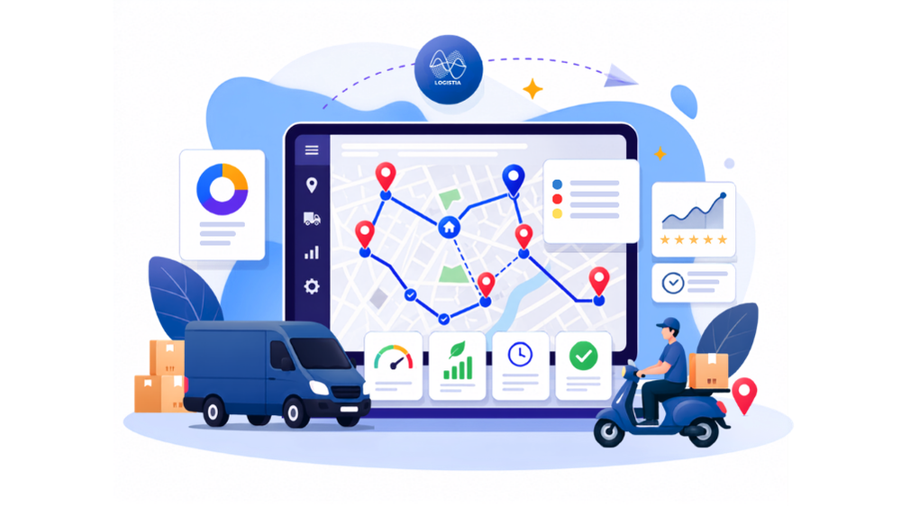
More than just a route planner
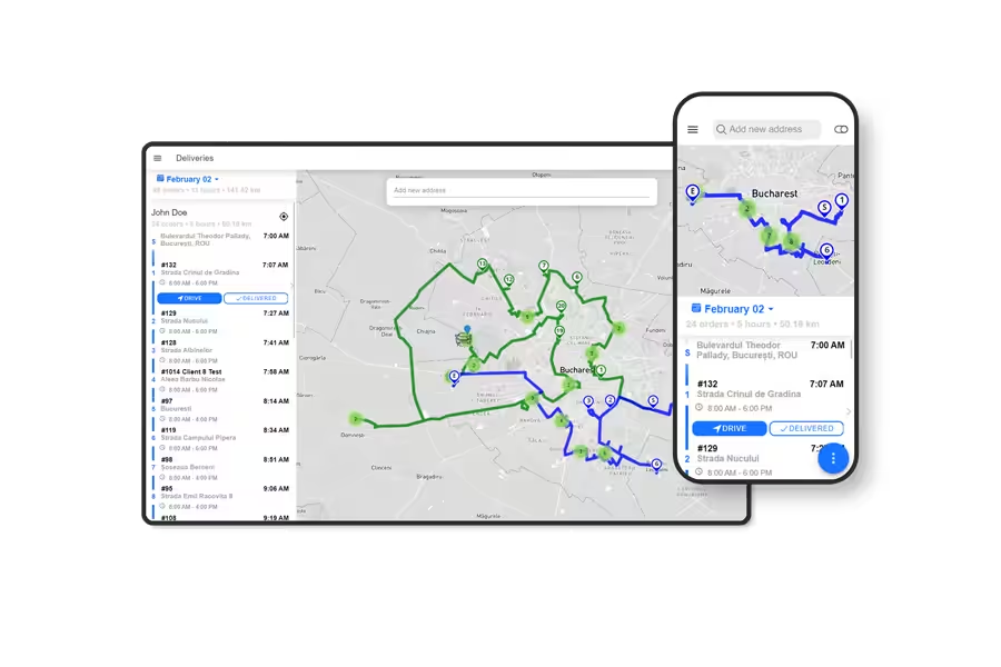
We know time is the most precious resource. With Logistia Route Planner you’ve got all the tools to add, optimize, and navigate smoothly to all your customers’ addresses in no time.
You’re in good company


You’re in Good Company
Suitable for every business
Optimize for maximum productivity. Smart technology for real-world operations.

Courier Services
Automate route planning with delivery areas for drivers and tracking links for customers.


Healthcare Services
Visit more patients efficiently and offer them the best care they deserve.

Inspection Services
Plan your routes well in advance for your team and track their progress live.


Installation & Maintenance
Make sure the right team is assigned each time within the requested time window.

Laundry & Cleaning
Pickup and deliver stellar service without sacrificing route efficiency.

Retail
Improve the operational efficiency of retail operations, ensuring smoother logistics and better customer service.

Pest Control
Streamlines scheduling and resource management for pest control companies, ensuring timely and accurate service delivery.
Groceries Delivery
Keep produce fresh and customers satisfied with temperature-aware routing and real-time delivery tracking.
Field Service
Complete more service calls per day by matching technician skills with job requirements while minimizing drive time.
How does Logistia Route Planner work?
There are a few simple steps you need to learn to start using Logistia Route Planner.
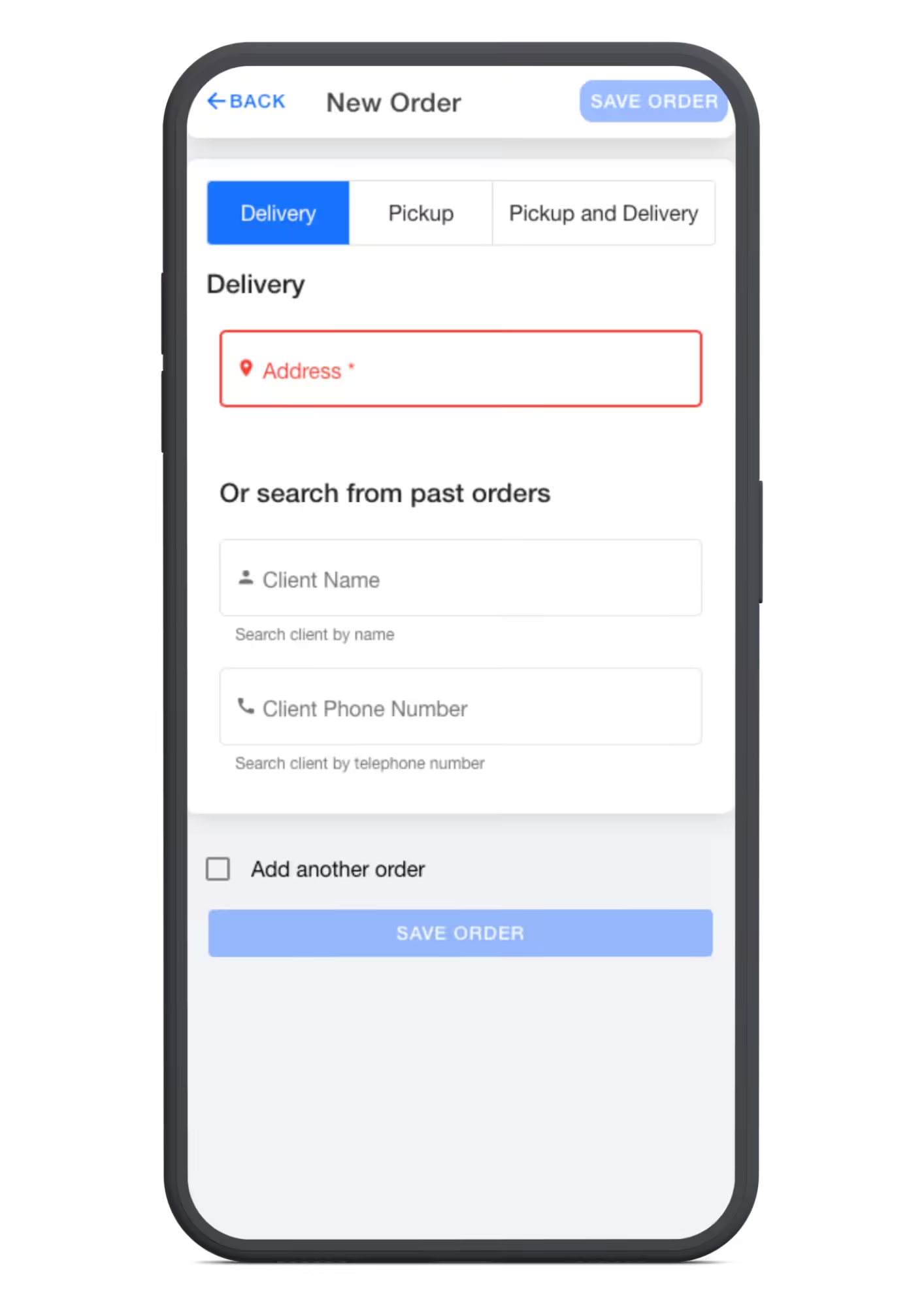
Add your stops
Start typing the address or import them into Logistia from multiple sources. Upload an Excel or CSV file, select orders from your e-commerce platform, or add stops by geopoint.
You can integrate APIs and we support multiple order parameters.
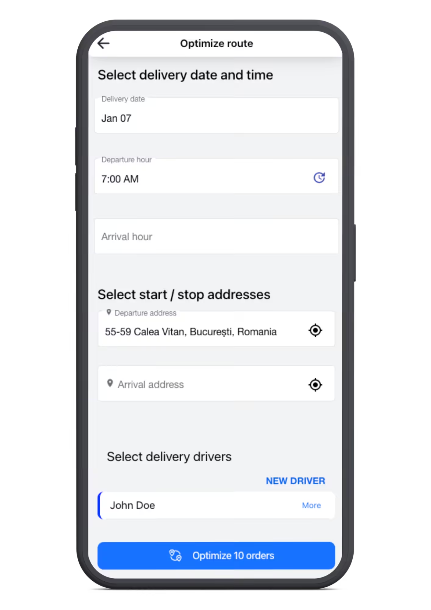
Plan the routes in your way
Optimize for all drivers or add individual settings. Set departure times and addresses for your drivers, and automatically assign stops to them as best as possible. Or pre-assign the stops yourself and edit the route to make it perfect.
See the route progress
Track drivers, notify customers, and capture proof of delivery. See where your drivers are in real time, send a tracking link to your customers, and capture the proof of delivery.
Logistia route planner integrates perfectly with
Your store and delivery ops should work together, not against each other. Connect with the platforms you already use, so order flow in and deliveries get delivered.

Shopify
Import your Shopify orders and turn them into optimized delivery routes in minutes, with automatic fulfillment once delivered

WooCommerce
Connect your WooCommerce store and manage your local deliveries without ever leaving your workflow.

Magento
Bring your Magento orders into Logistia Route Planner and keep your delivery operations running smoothly alongside your store.

Zapier
Connect Logistia Route Planner to hundreds of other tools through Zapier and automate the parts of your workflow to speed up your operations smoothly.

Squarespace
Run your deliveries from Squarespace store with Logistia Route Planner and keep your orders and routes in sync.
logistia route planner integrates perfectly with


logistia route planner integrates perfectly with
Try Logistia Route Planner today
Sign up for a free trial today and enjoy a flexible, easy-to-use last-mile delivery solution.
You can try it out for free for 14 days and see how our transport management software can transform your last-mile logistics operations. Take your operations to the next level, from anywhere in the world.
Do more with
Logistia Route Planner
The benefits of using our platform, as a route planner, for any business with people always on the move, available on any device.


See what our customers are saying